Safari Planning
A guide to planning your safari to the Okavango Delta
Read More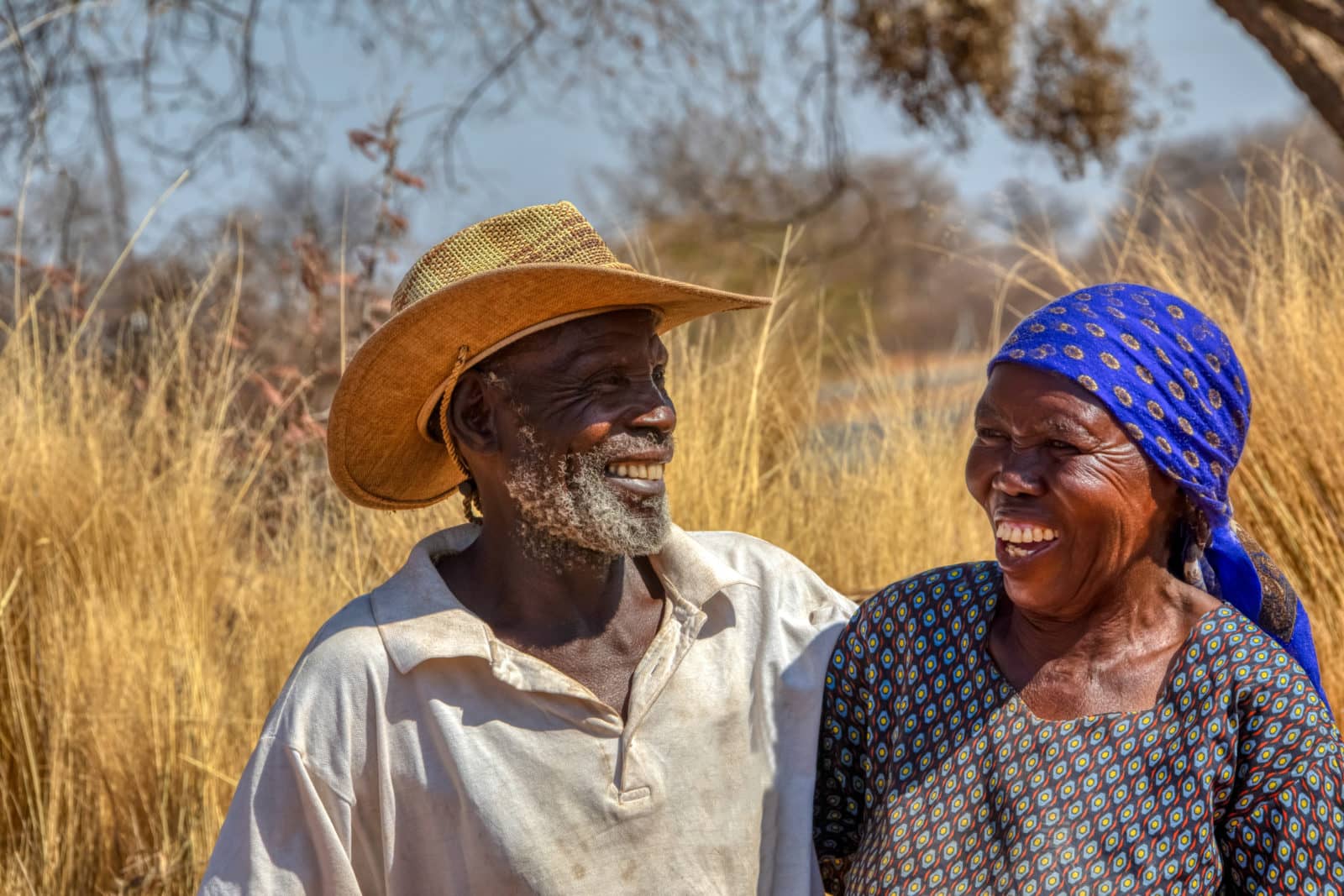
The future of the Okavango Delta depends on her people and how they choose to preserve this unique environment, balancing the needs of the wild with theirs as they transition from a traditional lifestyle to one associated with modern economics and commodities. Many of those living in this region are recent immigrants from elsewhere in Botswana leading to a population that is diverse in both character and origin.
Very few people live within the wetlands themselves with most living in towns and villages on the outskirts. Demographic information is thus aggregated for Ngamiland.
Early human association with the Okavango Delta is shrouded in legend, much of from the oral record. Sites such as the Tsodilo Hill, adorned with over 4 000 rock paintings, are claimed by several peoples, including the Hambukushu, Bugakhwe and Xanikwe, for example.
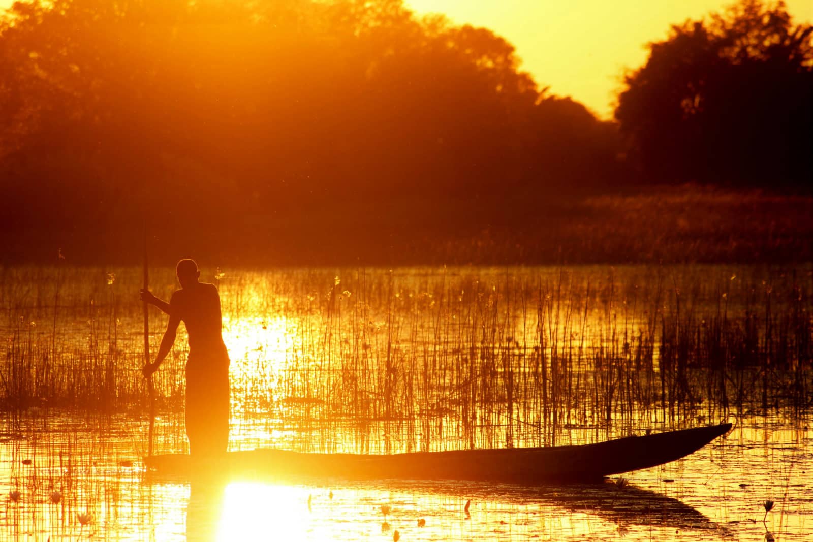
It is clear from archaeological records that northern Botswana has been occupied for the past 100 000 years at least and most probably for much longer before that. Evidence of this early occupation has been found at many sites around the Okavango Delta and it can be assumed that all areas between these sites were occupied at various times. The Delta’s natural resources, game, fish and indeed water, would have been vital to those that lived here with people who lived further away making excursions to gather food from the wetland.
The Delta’s first inhabitants would have been hunter-gatherers, perhaps the ancestors of today’s Bushmen, San or Basarwa. These populations would have been small, moving widely and frequently in pursuit of the sustenance provided by wild animals and plants.
With the introduction of livestock and crop farming by early Bantu people permanent settlements were established. These first farmers were, directly or indirectly the forefathers of the BaKgalagadi, Wayeyi and Hambukushu, Dxeriku, Herero and Tawana, although some of these groups may have settled the area more recently.
The history of the people of the Delta is characterised by frequent migration as people moved to new sources of natural resources and economic opportunities or to escape disease, both livestock and human, conflict, drought or flooding.
The Tawana people, for example, originally entered Ngamiland on hunting forays, establishing their first settlements in about 1800. Over the next 100 years they moved their capital no less than eight times with their last move to Maun in 1915. Livestock disease has played a role in the population dynamics of Ngamiland with the 1896 the rinderpest epidemic decimating the cattle population and sleeping sickness in the 1940s and 1950s leading to the abandonment of several villages in the Delta.
Historically conflict has played a role in the region’s population dynamic with raids by the Matabele in the second half of the 1800s forcing the residents of many settlements to flee. The German-Herero war from 1904 – 1906 lead to many Herero people escaping to Ngamiland. More recently in 1969 and 1970 the Hambukushu people have been relocated to the Etsha settlements of the panhandle to evade conflict in Angola.
The more gradual and less dramatic migrations due to the lure of new resources or economic opportunities are not as well documented and these movements continue to the present day with large numbers of people moving to urban areas.
In an area prone to variable rainfall and flooding with natural resources spread over vast areas people have had to be versatile with families having diverse sources of income. Activities also varied across the seasons or from one year to next, dependant on flooding, access to resources, labour and capital.

Distribution
The first official census of Ngamiland, derived by assembling and counting people at their headman’s village, revealed a population of 21 550 in 1904. This method was used again in 1911, 1921 and 1936. In the modern era the population has risen dramatically since the first modern census of 1964 from 42 572 people then to 138 654 people in 2006.
This increase in population is primarily due to better survival rates although migration has also played a small part. Prior to the introduction of health facilities the people of Ngamiland were often victim to malaria, sleeping sickness, tuberculosis and other diseases.
A decline in birth rates, as a result of women attaining progressively higher levels of education and then entering the formal labour market, has not lead to a decline in population with population growth in spite of declining birth rates, in Botswana from 6.6 in 1981 to 3.2 in 2003, as a result of improved survivability.
Population growth slowed in the late 1990s and early 2000s due to the impact of HIV/AIDs on the population. This situation has improved with increasing numbers of people gaining access to anti-retroviral drugs. Botswana was the first African country to provide anti-retroviral drugs to everyone in need.
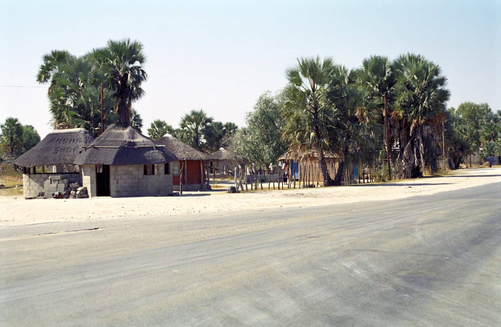
Very few people live in most areas of the inner Delta and the remote areas of western and northern Ngamiland. The settlements which do exist are extremely small. Most of the population lives in a cluster of larger villages and in Maun the district capital. These settlements along with Maun account for 84 800 people or 58% of Ngamiland’s population.
Ngamiland has developed rapidly in recent decades with a much higher percentage of the population entering the formal economy. This labour participation rate is illustrated by the fact that while in 1991 the majority (78%) of houses were constructed from traditional materials (built with labour) in 2001 almost half had corrugated iron roofs (built with cash). Other measures include improved levels of education and greater access to health care.
Farming
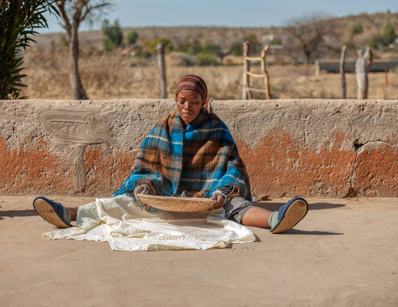
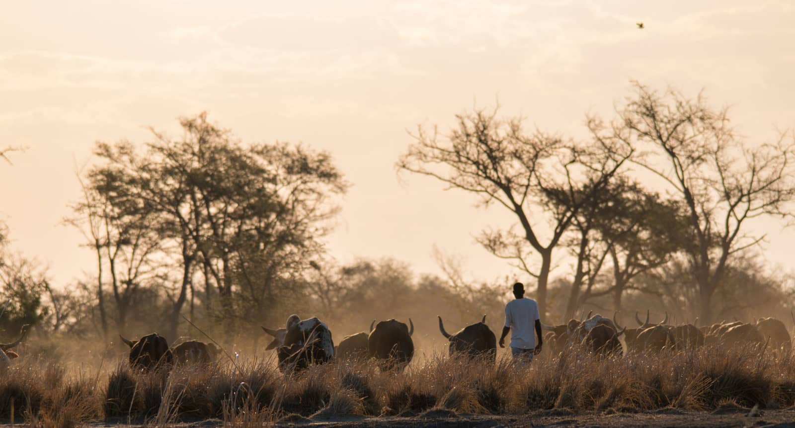
Agriculture in Ngamiland is predominated by livestock and crop farming. Much of this agriculture is subsistence in nature providing food for domestic consumption and, in the case of cattle, capital security and conducted in the traditional manner dependant on family labour and local natural resources.
Livestock graze outwards on a daily basis from cattle posts or from the homes of their owners. Cattle and goats are the most abundant stock but smaller numbers of donkeys and sheep are also held. Most stock is grazed on communal or tribal land south of the buffalo veterinary fence. Less than half of households have cattle and goats with the biggest herds belonging to relatively few owners. Goats are infrequently slaughtered for meat, whilst cattle are predominantly kept as a store of wealth. The exception to this are the Herero people who market cattle for commercial gain.
Crops are grown on rotation with nearly a four fifths (10 000 hectares of 48 900 hectares cultivated in 2000) of fields lying fallow each year. Fields are divided into dryland or rainfed crops and flood recession or molapo cultivation.
Molapo fields average two hectares and is cleared on ground that slopes down into channels or broader floodplains. Crops of maize, sorghum and vegetables are planted strips in late winter and spring. These strips lie parallel to the water lying on the floodplain or channels to benefit from the water remaining in the soil. Either too much or too little flooding is detrimental to the crop.
Dryland farming yields are lower than molapo farming and suffer from drought with the sandy soil not suited to retaining moisture.
Most farming supplements other forms of income including cash earnings, remittances and social grants. In 2003 it was estimated that at least 50% and as much as 76% of rural income was not generated by farming activities. Other figures show that farming is the most important activity for less than one in four rural households with its importance increasingly diminishing as people seek cash employment in towns.
Farming strategies within Ngamiland can best be described as low input, low output. Farmers seldom add fertilisers, compost or manure to improve soil fertility, as a result crop yields are low. With a significant risk of failure or loss extra investment in farming often doesn’t pay off. Both pests and diseases plague crops and livestock. Livestock have fallen prey to Rinderpest in 1896 and lung sickness (Contagious Bovine Pleuropneumonia) more recently.
Red-billed quelea and locusts and other pests strip crops which further suffer from a shortage of rain or water with drought an ever present problem, Botswana declaring droughts in 27 of 33 years between 1964 and 1997. Between 1982 and 1988 over a quarter or cattle in the district was lost to drought.
Low levels of production and limited market opportunities for surpluses mean that farmers are unable to earn reasonable amounts of money. With cash increasingly important people are driven from the rural economy despite government support such as support obtaining draught animal power, fencing materials, fertilisers and grants for stock farmers to obtain stock and equipment.
Land uses
Land in Ngamiland is either state owned or communal, often called tribal land. State land is directly managed by government departments while communal land is administered by the Tawana Land Board. State land includes the Moremi Game Reserve and parts of the Chobe National Park as well as several large cattle ranches and Maun itself.
The Tribal Grazing Land Policy of 1975 saw a large area of designated communal land divided into commercial ranches of between 4 000 and 7 000 hectares. The remaining land is divided into areas where the emphasis is either crop and livestock farming or wildlife and tourism.
The boundaries and broad purposes of the Wildlife Management Areas (WMA) were set in 1992 as part of a community-based natural resource management programme. The 29 WMAs are further divided into two types, rights for the use of 15 are leased to private enterprises whilst the remaining 13 are allocated to communities. The communities usually then enter into joint venture agreements with private enterprises. Local people benefit from income from employment as well as royalties. In addition to these income streams local people benefit from support to social services, such as schools and clinics.
Whilst agreements with tourism operators place restrictions on land uses, the economic conditions of people within the WMAs have substantially improved, especially where the benefits are shared amongst relatively few households. For example, while there were very few sources of cash in the settlements for Sankuyo, Khwai and Mababe prior to the joint ventures, over 50% of resident adults are employed by the joint ventures.
The Okavango Delta Management Plan, completed in 1998, and the Ngamiland Integrated Land Use Development Plan, finalised in 2009, seek to protect the economic and conservation value of the Delta’s natural resources for the country, international community and local residents. The plans seek to expand the zones for wildlife management whilst physically separating land use where the potential for conflict between both farming and wildlife and different kinds of farming is high.


Contact us for more information and to start planning your Okavango safari
Contact